|
| Wild campsite by the Altyre Burn (NJ041532) |
An early start today, up and packed by 06:45. Quick first breakfast and a swim for Rafe in the Altyre Burn and we were off, continuing north along the Dava Way. The pack was a bit lighter (but not much) and the track was flat and smooth, we made good time.
 |
| Scurrypool Bridge on the Altyre Burn |
The Way continued through the woods past
Scurrypool Bridge, where Rafe took another dip, fetching a few sticks thrown into the burn.
 |
| Rafe in the Altyre Burn by Surrypool Bridge |
The weather was a touch grey, but warm and humid as we sweated ever closer to the end of the Dava Way. The path left the route of the old railway as it passed through a wet cutting. A pleasant tramp along forest tracks, wild flowers abounded, but with a bit of extra up and down than we had become used to. Rafe was off into the undergrowth, sniffing and mooching about.
 |
| Dallas Dhu Distillery near Forres |
I was hoping there would be a cafe at the
Dallas Dhu historic whiskey distillery, just short of Forres, but no luck - being Sunday morning and still not 09:00. It looked like a good place to visit - definitely worth a trip on another day.
 |
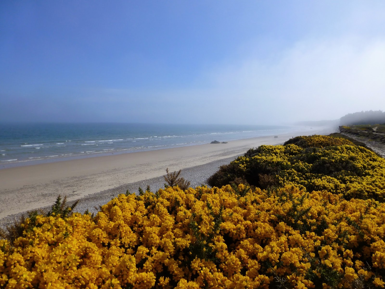
| The Dava Way near Forres |
The day started to brighten up a touch, still cloudy, but brightened by shining gorse and broom.
 |
| Rafe on The Dava Way near Forres |
The end of the Dava Way came suddenly, the only warning a bit of an increase in litter, depositing us in the middle of a housing estate (a very nice housing estate) on the outskirts of Forres.
 |
| The finish/start of the Dava Way in Forres |
Good waymarks continued though, taking us through the streets of Forres into the town centre, to the unofficial finish point at the
Falconer Museum (shut at this time on a Sunday, but I wouldn't have been able to go in with Rafe anyway). We had a short rest on the benches here, 7km or so under our belts already this morning.
 |
| The Falconer Museum, Forres |
Stopped in the shop for provisions for a second breakfast (and a treat for Rafe) and enjoyed the danish pastry sitting in the sunken gardens in
Grant Park - lovely.
 |
| Grant Park Sunken Garden, Forres |
Following the
Moray Coast Trail now, we passed the
Sueno Stone, the largest Pictish carved stone to be found, now encased in glass, before crossing the main A96 on the footbridge.
 |
| Sueno Stone, Forres |
A few kilometres of road walking came next, through pleasant, though very flat farmland. The roads were mostly quiet and Rafe was able to come off the lead once away from the main road, but we were happy to reach Kinloss.
 |
| The Muckle Burn, near Forres, with views to Kinloss Barracks |
Kinloss Abbey was well worth a visit and a good opportunity to divest myself of the rucksack for a while. Also a lovely spot to linger over a picnic lunch.
 |
| Kinloss Abbey |
 |
| Kinloss Abbey |
We continued north, tarmac bashing, along the Findhorn road, as the sun came out. Findhorn Bay, famous for wading birds and sailing boats, reflecting the brightness back at the sky.
 |
| Rafe guards the tent at Findhorn campsite |
We pitched up at the Findhorn Foundation campsite. Lovely, well equipped site with plenty of space for a little tent, a dog and footsore backpacker - I was glad of a shorter day and to drop the pack.
 |
| Rafe - "This is my bed now" |
It didn't take long to get the tent up and a brew on.
 |
| Findhorn Bay |
After a bit of a chill, laid out on the warm grass, and a look around the campsite shop (a good selection of local bottled beers) we took a walk into the village of Findhorn, another mile or so along the coast.
 |
| Findhorn Bay |
 |
| Findhorn Bay |
Rafe took a swim in the bay...
 |
| Rafe in Findhorn Bay |
 |
| Findhorn Bay |
 |
| Dunes at Findhorn |
And a run about the sand dunes.
 |
| Views east to Burghead from Findhorn |
I had a coffee at the beach front cafe, Rafe hobnobbing with the other canine customers.
 |
| Views west to Culbin Forest from Findhorn |
Back at the campsite we rested up before tea...
 |
| Views upwards from the Findhorn campsite |
And took an evening walk along the mudflats of Findhorn Bay, before turning in at sunset.
 |
| Forres across Findhorn Bay with the tide out |
Route: Altyre Bridge (NJ041532 7km south of Forres), continue on the waymarked Dava Way to Forres, follow the waymarks to Forres town centre and the Falconer Museum, E along High Street, NE to Sueno Stone (NJ047597), footbridge over A96, B9011 N to NJ050601, turn L at sp Milton of Grange, turn R at NJ043607, NE to Kinloss, B9011 to Findhorn.
 |
| Rafe - ? |
Statistics: Distance: 19.2km Ascent: 50m Time: 7 hours.