After a certain amount of excitement that we might get three good weather weekends running, we watched the forecast deteriorate over Thursday and Friday - typical.
Rain, sleet and strong winds were forecast in the west with a slightly better forecast for further east - so we went for what looked like the best bet, the southern Cairngorms.
We set off in sunshine and warmth and it was still bright as we drove through Blair Atholl - but by the time we arrived in the car park at Old Bridge of Tilt, it was raining - and not lightly!
 |
| Old Bridge of Tilt car park - information board and the start of the yellow walk |
We sat in the car for a few - is it getting brighter? Mmmmm?
Not really, but the forecast was for an improving afternoon, so, waterproofs on and off we go...
 |
| Beside the River Tilt, north of Old Bridge of Tilt |
We took the "yellow" walk from the car park, through the woods and (with a small detour) past the Falls of Fender - it was a pleasant start, through mixed woodland and farmland.
 |
| Walking north in Glen Tilt |
We've been for shorter walks in Glen Tilt before - with our lovely lost Rafie - so we recognised the initial paths and tracks, taking us gently up the western side of the glen and onwards to the Rifle Range.
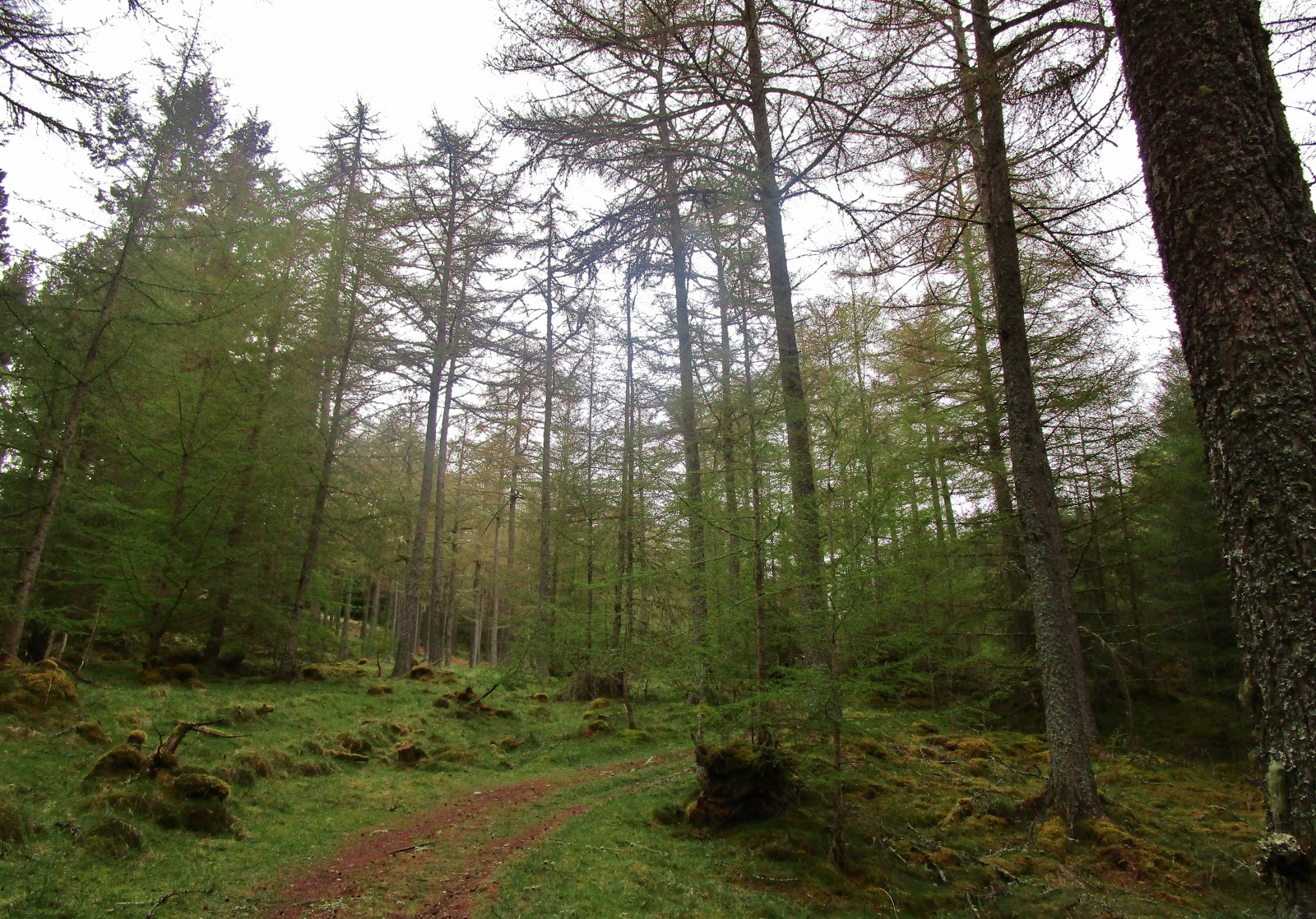 |
| Leathad Mor Wood, Glen Tilt |
The rain pattered gently on our jacket hoods...
 |
| Looking north over Glen Tilt from near the Croft Crombie Rifle Range |
The views were moody.
 |
| North from the Croft Crombie Rifle Range |
We continued along the good path through the rifle range - no shooting today, all was quiet. (If there had been shooting, we had planned to take the track up the glen on the other side of the river - our return route today!)
 |
| North along Glen Tilt from the Croft Crombie Rifle Range |
Despite the weather, Glen Tilt was lovely...
 |
| Jim - Ach-mhairc Bridge, Glen Tilt |
The path was good - varied underfoot, but obvious and easy. We crossed the Ach-mhairc Bridge over tumbling waterfalls (made more impressive by the continuing rain)...
 |
| Settlement (Sean-bhaile) at Ach Mhairc Mhoir - views east |
and took the short detour (signposted) through the abandoned Settlement (Sean-bhaile) at Ach Mhairc Mhoir - we stopped for a few minutes amongst the melancholy ruins. It was a sizeable settlement and must have been quite a community before depopulation.
 |
| Glen Tilt - views north |
We were due for a first lunch - so under a few trees, still only just showing the first signs of spring, we found a couple of logs to sit on and munched on a sandwich, taking in the views.
 |
| A good spot for a first lunch - Glen Tilt, Coille Sron an Duine - views south west |
 |
| Jim - Glen Tilt - views east |
It wasn't far to the start of the hill now,
 |
| Gaw's Bridge, Glen Tilt |
We watched a couple of golden eagles soar over the hills to the north, resting on the wind and spiralling round each other, before they took themselves off into the mist.
 |
| River Tilt, east of Gaw's Bridge |
We passed Gaw's Bridge - and after about 700m, once we had crossed over the footbridge over the Allt Craoinidh - we took the rough path north off the main track and started our ascent.
 |
| Jim - the start of the ascent of Carn a'Chlamain, on the east bank of Allt Craoinidh |
The path briefly followed the burn and its tumbling waterfalls, before striking off towards the north east and up the nose of Faire Clach-ghlais - reasonably steeply! A bit of a shock after our gentle walk in.
 |
| Jim - waterfalls on Allt Craoinidh |
Height was gained quickly and were rewarded with more moody views.
 |
| Views back down to Glen Tilt from the start of the ascent of Faire Clach-ghlais |
 |
| Ascent of Faire Clach-ghlais |
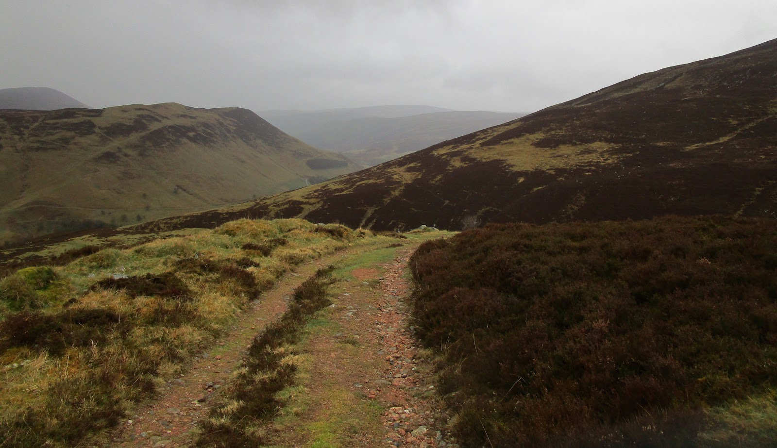
We soon reached the landrover track which would be our route almost to the top, zigging and zagging across the moor.
 |
| Views towards Beinn a'Ghlo from ascent of ascent of Faire Clach-ghlais |
It wasn't the most attractive of paths! It stood out like a sore thumb through the heather and it was something of a slog. Not physically hard going (apart from the rubbly bits) as it was never very steep, but it seemed to go on for ages.
 |
| Views back (west) from ascent of ascent of Faire Clach-ghlais |
The weather continued! Very occasionally it looked like it was going to brighten up. The clouds swirled away and we got some views - the camera came out and I snapped away.
 |
| Ascent of Faire Clach-ghlais |
But then the mist would descend again and the raindrops would get bigger and heavier - at least there was next to no wind. It would have been rather nasty to have it blowing in our faces.
 |
| Views back (west) from ascent of ascent of Faire Clach-ghlais |
 |
| Views towards Beinn a'Ghlo from ascent of Faire Clach-ghlais |
We took the little path across the moor at Glac a'Bhuic Eairb, cutting off a corner of the landrover track. It was marked by a little cairn, and wound off towards a mound to the north - gloomy in the grey - it was good to be off the landrover track
 |
| Leaving the main track and heading for the summit plateau of Carn a'Chlamain |
 |
| Jim - ascent of Carn a'Chlamain - Grainan Mor |
 |
| Jim - ascent of Carn a'Chlamain - nearing the summit plateau |
We pulled up into Grainan Mor and could see a bouldery summit, complete with cairn. Is that the summit?
We wandered over, our whole world now was a grey plateau, mist and rocks - better check the map then!
 |
| Is that the summit? - nope, it's another 500m and 60m of ascent to the NW - in the mist! |
Definitely not the summit - we still had another half a kilometre and a short final pull up some invisible dome ahead to the north west.
 |
| Jim - ascent of Carn a'Chlamain |
 |
| Jim - ascent of Carn a'Chlamain - that IS the summit! |
 |
| Jim - ascent of Carn a'Chlamain - the last little screeie bit! |
A final short pull up a bit of scree and we were at the summit...
 |
| Jim - ascent of Carn a'Chlamain |
Carn a'Chlamain (Munro 192, 963m) was our 172nd Munro - feels like we're starting to get there!
 |
| Carn a'Chlamain (Munro 192, 963m) - views SE along the ascent route |
And the mist cleared! Just enough to get a few pictures, a bit of the atmosphere of the place :)
 |
| Misty views from the summit of Carn a'Chlamain |
We hunkered down, just below the summit, out of a pesky wind that had got up at the top and settled in for a damp second lunch (still raining) and to breathe in that Cairngorm air.
 |
| Misty views from the summit of Carn a'Chlamain - and a soggy second lunch |
Every now and again we got a brief view of the hills around - including Beinn a'Ghlo, with it's three Munro's - before the cloud roiled in again
 |
| Jim - descent from Carn a'Chlamain summit |
Unfortunately that Cairngorm air was a bit too chilly and that pesky wind was a bit too penetrating for sitting very long. The rain definitely had a touch of sleet in it - and when the rain became wet snow it was definitely time to move.
 |
| Views east from Carn a'Chlamain to Beinn a'Ghlo |
We descended quickly from that summit cone - just as the weather started to brighten again.
 |
| Looking back at Carn a'Chlamain summit - the clearest view all day |
 |
| Jim - descent from Carn a'Chlamain |
 |
| Looking back at Carn a'Chlamain summit |
...for about 30 seconds - before the drops increased again.
 |
| Jim - descent from Carn a'Chlamain - Grainan Mor |
But the mist/cloud had cleared somewhat, so we were getting some better views. We had acknowledged that the weather was set in and it was probably as good as it was going to get.
 |
| Views west from descent over Faire Clach-ghlais |
That landrover track got us down pretty quickly - it was never very steep and it hardly felt like the "descent" you come to expect - sore knees and toes!
 |
| Jim - views down into Glen Tilt from Faire Clach-ghlais |
We were very soon back in Glen Tilt. We crossed Gaw's Bridge and sat on a wall above the river for another lunch!
 |
| River Tilt |
It felt positively balmy down in the glen.
 |
| A good place for a third (and even soggier) lunch - Gaw's Bridge, Glen Tilt |
And there were people about - a couple of walkers and a group of runners - the first people we had seen all day since leaving the car park!
We walked back on the south east side of the River Tilt - it was more of a road than a track and whilst it was easy walking, pretty flat and smooth - it was a long way of hard stuff underfoot at the end of a fairly long walk - I was glad to get my boots off at the end.
The river was just stunning though - cascading through narrow gorges, over smooth slabs, through rocks and rapids and contrasting with tranquil pools. I think we'll have to come back on a sunny day for a different Glen Tilt experience.
PS - you know it's been a wet day when you can squeeze water out of your tee shirt!
 |
| Jim - return along south/east bank of River Tilt |
Route: Car park at Old Bridge of Tilt (NN874662), follow the yellow route out of the car park (starts just to the left of the information board), over the road on a stone fb, and following the River Tilt N out of the village, continue to follow yellow route through Lethad Mor Wood, along side of field, taking left fork up the hill at NN878683, continue to follow the yellow route, turning R when a track is reached (NN876685) and N through the rifle range and beyond, along and above the W bank of the River Tilt, after fb over Allt Craoinidh (NN908720) take rough path NNE up nose of Faire Clach-ghlais to meet landrover track at NN908724, ascend track NE to Glac a'Bhuic Eairb (NN923748 approx) and take rough path (marked by a small cairn) N onto summit plateau, then NW over a couple of minor tops to summit (Carn a'Chlamain, Munro 192, 963m), return by same route to fb over Allt Craoinidh (NN908720) and back along track to Gaw's Bridge (NN901718), cross bridge and follow track along S bank of River Tilt SW to Cumhann-leum Bridge (NN881685) continue along track to Old Bridge of Tilt and the start
Map: OS Explorer 394 Atholl
Carn a'Chlamain


