|
| Moruisg from the start point beside the A890 |
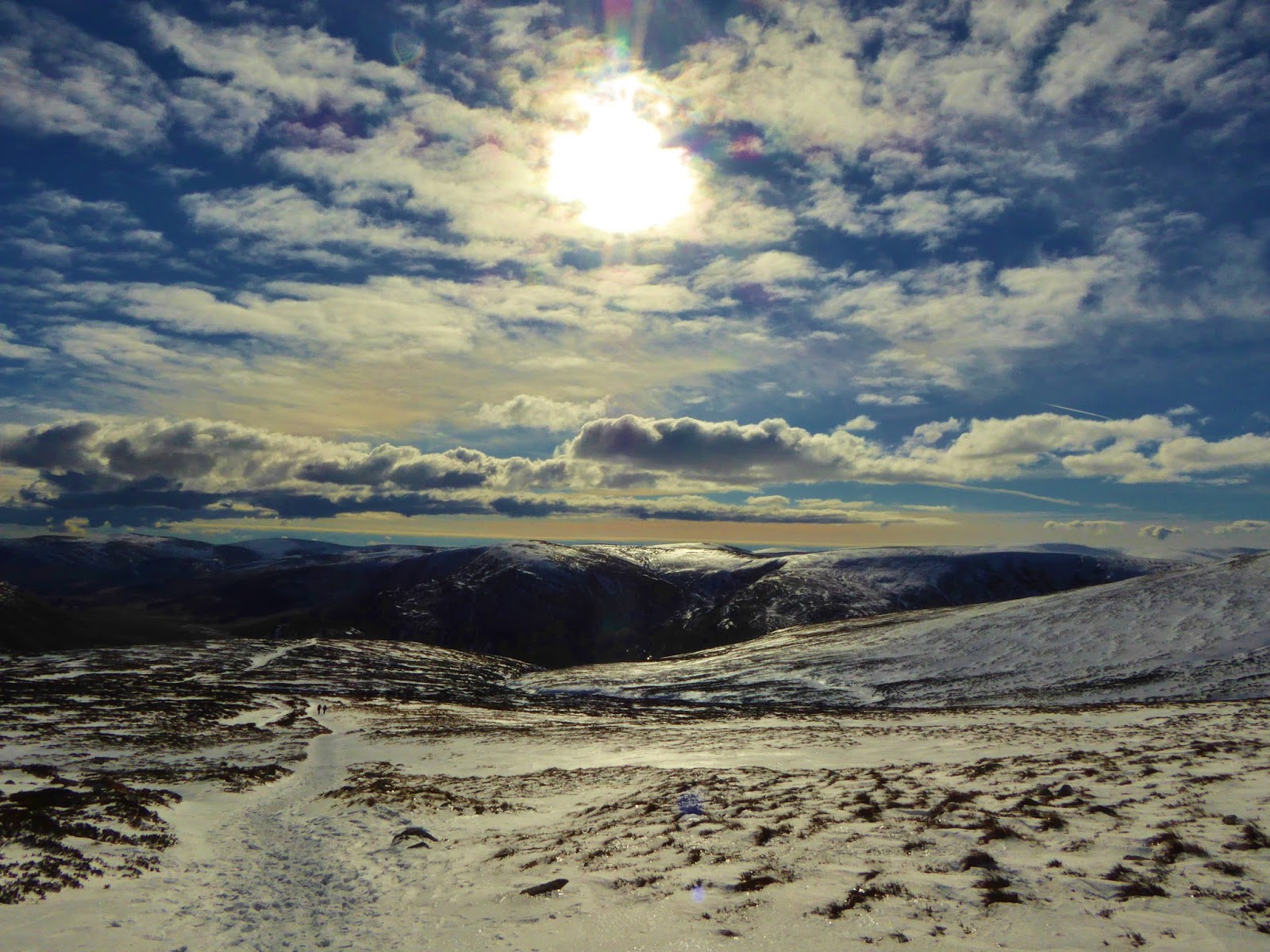
We'd two walks in mind - another walk in the Monadhlaith, or Moruisg, near Achnasheen. Both walks have a bit of a rep for being boring, boggy lumps - so a winter outing might just pep up the interest and freeze up the bog.
We'd been watching the
weather and the
avalanche forecast for a few days - both had been a bit up and down. By the end of the week the weather was drying up, but with strong easterlies forecast, the best chance of good visibility was in the west. The avalanche risk had gone up from moderate to considerable - but Torridon looked better than the more easterly forecast...
Moruisg it is.
We planned to team the Munro with Sgurr nan Ceannaichean, a Corbett (which used to be a Munro), just to the south of Moruisg.
 |
| North east along the River Carron from the footbridge at NH082520 |
An early start from home, saw us setting off from the little layby on the A890, in Glen Carron, under a chilly looking Moruisg, the sun still behind the hill, just before 10am.
 |
| In Glen Carron with views south to Moruisg and Sgurr nan Ceannaichean |
Across the River Carron foot bridge and under the railway line, we were soon yomping across the frozen moor (it would certainly have been a bog trot, if not for the temperature!).
 |
| Railway underpass in Glen Carron |
We were soon ascending into patchy snow, Rafe bounding about, chucking it in the air and playing catch!
 |
| Loch Sgamhain from the start of the ascent of Moruisg |
 |
| West along Glen Carron to Sgorr Ruadh |
There was a vague path, intermittent in the heather, grass and snow. There were a couple of gates through the deer fence to negotiate and then we just went up.
 |
| Frozen burn on Moruisg lower slopes |
 |
| Jim - ascent of Moruisg |
 |
| Views west along Glen Carron - Moruisg and Creag an Ardaich |
 |
| Frozen burn on Moruisg |
It was a fair, steep slog, but as we ascended, the sun came up over the mountains, lighting up the scene. The glorious hills of Torridon were spread out to the west, behind us - we had every excuse to stop and stare...
 |
| Ascent of Moruisg - views west along Glen Carron to Sgorr Ruadh |
 |
| Jim - ascent of Moruisg |
The forecast was for the easterly wind to drop from 45mph (60mph gusts) to 25 mph (40mph gusts) by the middle of the day. As we were heading up the north westerly slope, we had been reasonably sheltered so far and we were hoping that the forecast drop in the wind would have kicked in by the time we neared the top.
It didn't. In fact we felt that the initial forecast was a bit on the conservative side!!
 |
| Snow devils - Ascent of Moruisg |
As we got higher, great gouts of wind, swirling snow devils, hit us more and more often. For the most part it was exhilarating and sometimes funny. But every now and again, dropping to the knees and waiting out the squall was the only way to stay on the hill!
 |
| Across Glen Carron - Fuar Tholl, Sgorr Ruadh and Beinn Liath Mhor |
 |
| North over Glen Carron to Beinn na Feusaige with the Fannichs beyond |
 |
| Rafe - White out on Moruisg |
 |
| Jim - Taking cover from snow devils on Moruisg |
But between the gusts, the views were magnificent.
 |
| Winter sun on Moruisg - views north to distant Fannichs |
 |
| Sun rises over Moruisg |
 |
| West over Glen Carron to Torridon |
 |
| Windy on Moruisg |
Higher was definitely colder, the snow got deeper, turned crispy and very soon icy... Crampons required.
 |
| Snow devils on Moruisg - views to Torridon |
The wind was blowing directly into our faces now, as we neared the summit plateau, constant and strong, two step's forward and one back. Hard work!
 |
| Christmas cake Moruisg |
But it was clear as a bell. I don't think we've ever had better views...
 |
| Snowy upper slopes on Moruisg - views |
We topped out on the icy summit plateau, beside a large cairn and a snow filled "shelter". Not much shelter to be had here.
It was about 200m south west along the plateau, to a smaller cairn, the summit of today's Munro.
It was extremely windy!
 |
| Jim and Rafe lean into the wind on Moruisg summit plateau - views south |
Walking the short distance across the icy plateau convinced us that today was not a day to be on the summits for any length of time. We made the decision to head back down into Glen Carron and not take on Sgurr nan Ceannaichean - the hills would still be there another day!
 |
Moruisg summit plateau - views south
Sgurr a'Chaorachain, Sgurr Choinnich and West Monar |
I'm lucky that I don't really suffer with cold hands - I rarely wear more than my excellent
Extremities dri lite gloves, (they're brilliant for using the camera!) - but today they definitely they weren't adequate. The -15C windchill turned my fingers numb. I was lucky to get any photo's at all.
 |
Views west from Moruisg summit plateau
Glen Carron, Fuar Thol, Sgorr Ruadh, Beinn Liath Mhor, Liathach and Ben Eighe |
We soon reached the summit - Moruisg (Munro 255, 926m).
We had a very quick photo session. There was no point in trying to hold the camera still or even point it in any particular direction - I just had to hope that the excellent light and the superlative views would make up for the lack of any framing!
 |
| Moruisg summit (Munro 255, 926m) - views north east |
We soon turned about and headed back across the plateau. Rafe was just loving it - leaping about, trying to catch the bits of snow and ice that were flying about.
Once back at the shelter, we met up with another couple of walkers, who had ascended from the south east. They were having a spot of lunch and enjoying the views before making back to the glen. Rather than join them, we decided to find a slightly more sheltered picnic place.
 |
| Rafe and Jim - descent from Moruisg - views west to Torridon |
With the wind at our backs and gravity on our side, we were very soon out of the worst of the wind. We were now blessed with the views of Torridon before us - and now that my hands had defrosted, I took many photographs.
 |
| Descent from Moruisg - views north to The Fannichs |
 |
| Ben Eighe from Moruisg |
As we descended we dropped into the edge of one of the larger gullies on Moruisg's west face. A frozen waterfall was draped into the depths, icicles hanging from every rock. We were in the sun and out of the wind - seemed like a good place to stop for a sarnie and a cuppa.
 |
| Descent from Moruisg - Jim - frozen waterfall in gorge (NN095505) |
 |
| Pretty good spot for lunch - views west over Glen Carron |
Can't think of anytime when we've had a better picnic view.
 |
| Rafe and Jim - Lower slopes of Moruisg - views north |
Once off the steeper slopes, we made good time. The wind had dropped. The gloves and hat were off.
 |
| Descent from Moruisg - Jim and Rafe, Glen Cannich |
There's been some tree planting - pine and birch - across the glen. Looking forward to a much more varied landscape in the future...
 |
| Loch Sgamhain and Beinn na Feusaige |
The afternoon sun had softened Moruisg's bogs - we had to make a few more detours around the gunky bits - Rafe didn't bother!
It was warm enough to sit out by the car, taking off the boots and having another cuppa, by the time we got back - with a pretty good view of where we'd just been...
A very short hill day - but definitely not boring and really not too boggy!
 |
| Moruisg in the afternoon sun at the end of the walk |
Route: Car parking area beside A890 Glen Carron Road 1km W of bridge over Allt Coire Cruaibh (NH080520), E to fb at NH082520, SE to railway underpass at NH083519, SE on open hillside to neck of land at top of two gullies (NH096506), continue SE on open hillside to summit plateau at large cairn and shelter, SW for 250m to Moruisg summit (Munro 255, 926m) at smaller cairn, return to start.
Statistics: Distance: 7.5km Ascent: 800m Time: 5 hours
Map: OS Explorer 429 Glen Carron & West Monar