|
| Rafe - Setting off from the car park in Glen Benchor near Newtonmore |
It was a bit grey when we set off from the little car park at the end of the Glen Banchor road. We had high hopes that the cloud would lift as the day wore on (as forecast by the Met Office) or that we would pass through the cloud and be treated to a temperature inversion on the summits (as forecast by MWIS).
Aww well...
 |
| Allt a'Chaorainn - views north into the mist |
Although there were no mountains to be seen in the Monadhliath this morning, the air was fresh and it was good to be out. Rafie bounded ahead, looking forward to a proper leg stretch. Last time we had been here, in January, there had been lots of snow - we had climbed
Carn Dearg, the Munro next door to today;s walk.
We headed north on the good track above the eastern bank of Allt a'Chaorainn, chuntering nicely with snow melt. We took the advice of the guidebook and passed the footbridge, deciding to keep to the better path until opposite the path up into Coire Dubh (and onto A'Chaillaich, our first objective of the day).
 |
| Rafe and Jim looking for a good place to ford Allt a'Chaorainn |
We hopped and jumped from boulder to rock and were soon over the burn and on the somewhat intermittent path, the snow, melting higher up, using the path as the easiest route off the hill...
 |
| Rafe and Jim start the ascent of A'Chailleach |
We could see the little mountain hut, red roofed, ahead of us - a bit of a squelch up the heathery hillside and past the first snow of the day - and we were soon at there...
 |
| Ascent of A'Chailleach - mountain hut |
It was a basic little place, no frills, but a bench to sit and drink in the views...
 |
| Mountain hut on A'Chailleach (NH607002) |
 |
| View east from mountain hut (NH607002) |
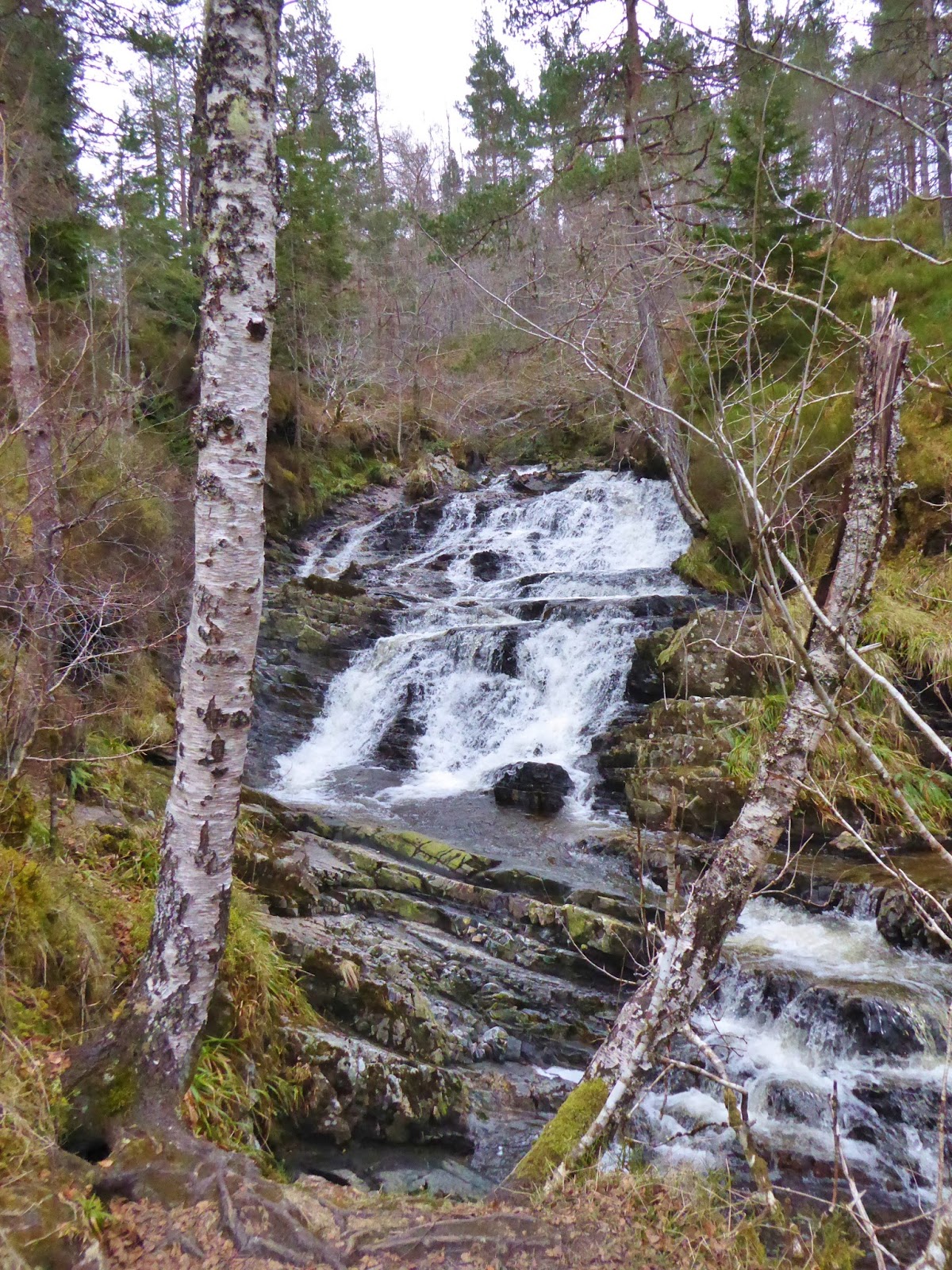
There was a waterfall to be seen, north above the hut, a cataract, swollen following a week of milder weather - definitely worth a view - we headed off, always ready for a photo op... Lovely.
There were mountain hare everywhere, popping up and dashing off over the snow. Rafie's nose was all a quiver.
 |
| Waterfalls (NH685024) on ascent of A'Chailleach |
Now, if we had wanted to take the path straight up to A'Chailleach we should have headed north east from the waterfall to the next watercourse and then have followed the path north west up this watercourse initially and then north east across the open hillside directly to the summit.
As it was, we headed up the snow filled watercourse above the waterfall, a smoothly rounded ascent into a white world. As the snow increased, we climbed gently into cloud. Horizon, sky, ground, all merged into one - strange and disconcerting, there was no distance or perspective. The compass told us we were still going in the right direction, and we just kept going until we reached the bealach, north west of Geal Charn (another one!).
 |
| Into the mist - Rafe and Jim - ascent of A'Chailleach |
We turned right and followed another bearing over an insignificant hummock and up the final 90m or so to the summit of our first Munro of the day - A'Chailleach (Munro 251, 930m).
Gradually the snow cover decreased, until it was gone and we were crossing grassy slopes.
Gradually the thickness of the cloud decreased, we could see blue sky above...
 |
| Nearing the summit of A'Chailleach - not much of a view! |
But sadly it didn't clear out, it was bright, and a watery sun could be seen through the mist, but we got no views.
 |
| A'Chailleach summit (Munro 251, 930m) |
There was a shelter next to the large summit cairn, so after a few summit photo's, we got tucked in, out of the chilly breeze that had suddenly got up, we had our first lunch. We were ready for a cuppa!
 |
| In a white and misty glen, NW of A'Chailleach |
It was a day for bearings. Another twizzle of the bezel and off we went. We headed down into the little glen of Allt Cuilna Caillich just to the east of the high point (sh 822m) to avoid the most gorgy bit. By the time we reached the bottom of the glen the snow cover was complete again and the cloud was thick and damp.
We scrabbled up a short, steep, very snowy bit, before striking out, (on another bearing!) towards our second Munro, Carn Sgulain.
 |
| From Carn Sgulain summit (Munro 271, 920m) |
It seemed quite a trek, concentrating on walking on a bearing from each insignificant object to the next. There was very little in the way of landmarks and when the snow cover was complete, Jim went out ahead and was directed left and right...
Eventually we came to the little summit cairn - Carn Sgulain (Munro 271, 920m).
Carn Sgulain has the reputation of being one of the most insignificant and least prominent of Munro's, just a rolling lump - but with a wonderful view over the empty wilds of the Monadhliath. We cannot testify to either. We could have been anywhere!
 |
| Ptarmigan on Carn Sgulain |
But the air was fresh and sharp, we had bagged two more Munro's and we had had more navigation practice than we've had in many a long day... and we still had a goodly way to go.
 |
| Descent from Carn Sgulain into glen (NH674042) |
We set off back across the snow the way we had come - our footprints aiding with the navigation - down into the little glen and back up to A'Chailleach.
 |
| A'Chailleach summit again |
If anything, the cloud was thicker on the summit of A'Chailleach than it was before. We decided to drop down a bit, before stopping for a second lunch.
 |
| Descent from A'Chailleach iinto Glen Allt a'Chaorainn |
Another hilltop, another bearing - and oh, look! - a path, heading south west into Coire Dubh. The mist was soon thinning and we were getting some views - not least, of mountain hare and ptarmigan all across the moorland.
 |
| Mountain hare on A'Chailleach |
It never seems to take long to lose height.
 |
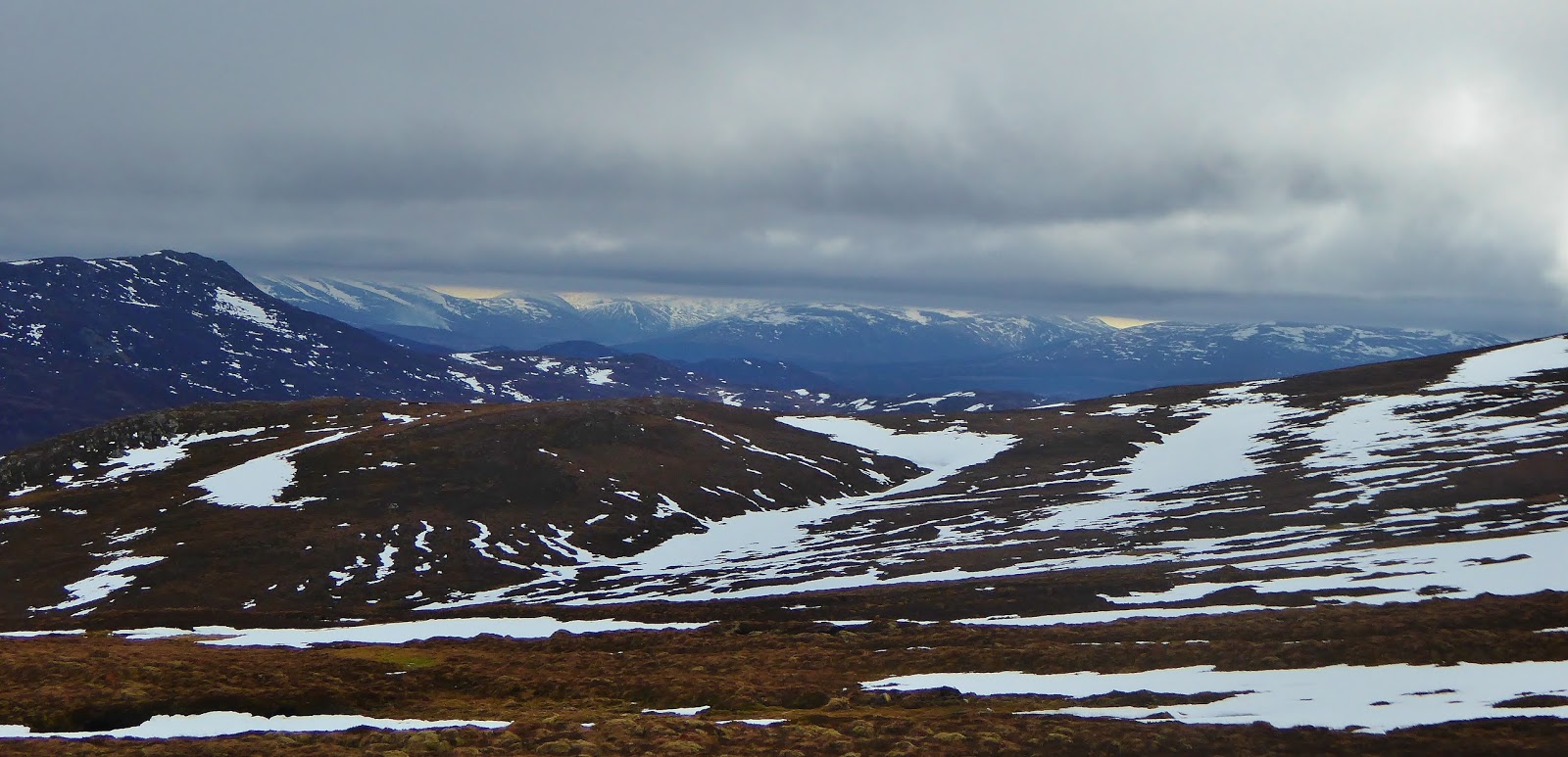
| Descent from A'Chailleach - some views at last - east to the Cairngorms |
We soon came out of the mist. And as we watched, the cloud started to lift...
 |
| North to A'Chaileach amd Am Bodach |
 |
| Descent south east from A'Chailleach - Jim and Rafe |
It wasn't long before the lower tops were clear, and as we made our way towards the mountain hut, a little red landmark amongst the browns and yellow of the hillside, the rest of the hills showed themselves. Many photographs were taken.
 |
| South from decsent from A'Chailleach |
 |
| Peat hags - descent from A'Chailleach - Rafe and Jim |
The intermittent path was somewhat boggy, but we made good time.
It felt almost balmy as we descended and arriving at the little mountain hut felt like a homecoming. We brought the bench outside and had a second lunch in the almost sunshine, with the Monadhliath to our right and the Monadh Ruadh to our front.
 |
| Snow melt - descent from A'Chailleach |
There had been an appreciable amount of water added to the Allt a'Chaorainn whilst we had been on the hill. We decided to brave the west bank path and cross at the footbridge further down. To be quite honest, we enjoyed this path much more than our outward route, close to the burn and much more interesting!
 |
| Allt a'Chaorainn - views south |
The footbridge was tucked into the landscape at the top of a little gorge, only visible when almost upon it - and fluttering with mine tape! It had obviously been damaged in some storm. We went to investigate.
 |
| Dilapidated bridge over Allt a'Chaorainn - do not cross! |
It did look rather worse for wear and there were hand written signs by the bridge advising not to cross. It looked like there had been some attempts to shore the bridge up and the mine tape had been pulled away. We went across the bridge one at a time and it seemed ok - we've been across more rickety structures! But if you go that way, do your own risk assessment.
 |
| Looking back to A'Chailleach now that the mist has lifted |
It was less than 2km back to the car park, back on the good track.
The mountains were now clear and stark against the sky - proper Scottish winter mountains and a proper Scottish winter sky.
 |
| West to the Monadhliath from Glen Banchor near the end of the walk |
Route: Car park at the end of Glen Road, W of Newtonmore (NN693998), N along track into Glen Allt a'Chaorainn, continue N on deteriorating track to NH693017, ford Allt a'Chaorainn and head W on intermittent path to hut at NH607002, NW to waterfalls at NH685024, NW along bun to sh 855m at NH681035, NE over minor summit sh 865m, bealach sh 846m, continue NE to A'Chailleach (Munro, 251, 930m), W into glen NH674042, NW to sh 848m (NH673047), NE to Carn Sgulain (Munro 271, 920m), return to glen, return to A'Cheallaich, S on intermittent path to NH681031, SE to hut (NH607002), SE to Allt a'Chaorainn, S along burn to fb at NH690012, follow track S to start.
Statistics: Distance 17km Ascent: 900m Time: 7.45 hours
Map: OS Explorer OL56 Badenoch & Upper Strathspey