Saturday 24 September 2011

Ravenscar to Scalby Mills, North York Moors.


Robin Hoods Bay from Ravenscar

A bit of glorious weather at the end of September, so Freddie and I set out for a walk from Ravenscar, along the Cleveland Way to Scarborough.

We started walking north from Ravenscar, for a brief look around the remains of the Peak Alum Works, above Robin Hoods Bay.


Raven Hall Hotel and Ravenscar from
the Winding House, Peak Alum Works

The Alum House, Winding House and Brickworks received a visit, before we headed back up to Ravenscar and then south along the cliff path.

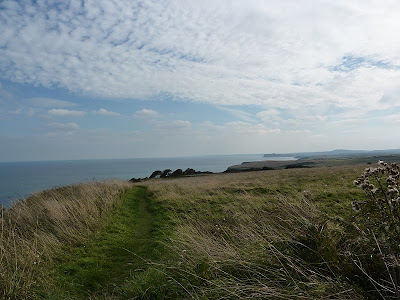
Robin Hoods Bay from just north of Ravenscar on the Cleveland Way
 
 The views were great and the weather marvellous.

Beast Cliff, south of Ravenscar on the Cleveland Way

We had lunch on the beach at Hayburn Wyke, beside the waterfall. The dogs had a bit of a paddle, chasing sticks thrown into the pool at the bottom of the waterfall.


Hayburn Wyke, Rafe has a paddle
 
It was quite busy along the route, walkers making the most of the lovely weather. We were also overtaken by a number of runners, taking part in an event, running 67 miles from Saltburn to Hunmanby.

Hayburn Wyke from the south, Cleveland Way

Soon after climbing the steepest bit of the route, out of Hayburn Wyke, we caught out first glimpse of Scarborough Castle.

Looking south, along the Cleveland Way from Iron Scar,
with Scarborough Castle in the distance

We arrived at Scalby Mills by late afternoon. Another great day on the Yorkshire coast.

Cloughton Wyke, Cleveland Way

Route: Ravenscar (NZ980015), north west along footpath to National Trust Peak Alum Works, explored the Alum House, Winding Engine area and Brickworks, returned to Ravenscar via old railway track, Cleveland Way south to Scalby Mills.

Statistics:  Distance:  20 km  Ascent:  585m  Time:  5:30 hours

Friday 2 September 2011

On Thirlmere - A Week in Cumbria - Day 7.

After our regular early morning walk around High Stand Woods, we set out, on a rather gray day, for a paddle around Thirlmere.

We set off from Armboth car park (NY305171), and headed south, keeping quite close to the shore as it was a touch choppy.

We kept to the west of Deergarth Island, but the water was so low that we were forced to port the canoe over the shallows.

Thirlmere - looking south from Hawes How Island

We paddled further south along Thirlmere and stopped for a barbecue on Hawes How Island


Hal - on Hawes How Island,
Thirlmere


Rafe - Thirlmere
The weather was improving all the time and the afternoon was lovely and sunny, if a touch windy.


Hawes Howe Island, Thirlmere - Rafe and Hal

Rough Crag from Hawes How Island, Thirlmere

We continued south, stopping near Dobgill Bridge (NY319139), then on to the southern end of Thirlmere.

Near Dobgill Bridge (NY319139), Thirlmere


South from near Dobgill Bridge (NY319139), Thirlmere

Then wound back towards the north, around the islands, and back to the start.


Thirlmere - looking north towards Great How and Blencathra

A lovely day on the water.

Back at the campsite we had a last evening walk around High Stand Woods before turning in.

Saturday meant the long trip back home - after a last walk around the woods and lakes beside the campsite.

We'll be back in the Lakes soon.

Thursday 1 September 2011

Whiteside and Beyond - A Week in Cumbria - Day 6.

We had our regular walk around High Stand Wood and lakes before breakfast, and then set out for a day on the Fells. The weather was set fair.

Whiteside, Hopegill Head and Grasmoor.

Views to Buttermere and Red Pike from near Grassmoor End

We set off with a couple of other groups of walkers making for Whiteside. One group we soon left behind, the other group yomped off ahead and we spent the day catching up with them and then falling behind.

A warm, humid and hazy day, but we still enjoyed the views, if not the heat.

Gasgale Gill


Ascent of Whin Ben


Whiteside from ascent of Whin Ben

Looking back at Whin Ben from ascent of Whiteside - Views to Crummock Water and Mellbreak
  
A steep ascent through beautiful purple heather to Whin Ben and then to Whiteside.


Gasgale Gill and Coledale Hause from ascent of Whiteside


Prostrate juniper on Whiteside


Whiteside ridge and Hopegill Head


Grassmoor, Gasgale Gill and Crummock Water

It was very different to our last time on the summit. Two Augusts ago, we summitted Whiteside from Dodd, in thick mist with about 10m visability. The rocks had been wet and slick, and the strong gusty wind had us imagining falls from the "ridge" to a sticky end far below in the abyss we couldn't see. Not today. Great views of the ridge ahead.

Whiteside ridge to Hopegill Head - Rafe and Hal

We had our lunch near the West Top, just out of the wind.

Whiteside ridge - Jim and Freddie

An entertaining ridge followed with great views. We had a second lunch at waterfalls on Liza Beck near Coledale Hause.


Summit of Hopegill Head
Grasmoor, Gasgale Gill and Whiteside ridge


Coledale Hause and Crag Hill

Liza Beck in Gasgale Gill

We took a route up Grasmoor away from the paths, around the crags. It was very windy on the summit, but once again with amazing views right across the Lake District.


Hopegill Head, Sand Hill and Grisedale Pike from ascent of Grassmoor


Views north from Grassmoor


Grassmoor summit plateau

 A steep descent through glorious heather again on Lad Hows. 

Descent to Lad Hows - Views to Whiteless Pike


Lad Hows


Views south east from Lad Hows to Rannerdale Knotts, Buttermere and beyond


Grassmoor from Cinderdale Common


A short walk alongside the road took us back to the car and an ice cream in Buttermere.


Grassmoor

Route: Car park at roadside (NY160199), road north to footpath (NY159208) at Liza Beck, Whin Ben (418m), Whiteside West Top (Birkett 134, 707m), Whiteside East Top (Wainwright 84, Birkett 126, 719m), Gasgale Crags (Birkett 137, 703m), Hopegill Head (Wainwright 53, Birkett 82, 770m), Sand Hill (Birkett 93, 756m), Grasmoor (Wainwright 20, Birkett 27, 852m), Lad Hows (Birkett 419, 426m), descend to road and start.

Statistics:  Distance:  11 km  Ascent:  1050m  Time:  5 hours

Another evening dog walk arounh High Stand Woods finished us off for the day.

Beinn Bhrotain and Monadh Mor

Setting off from Glen Feshie - it was chilly - before the sun had a chance to peep over the hills...  Off we go! Jim - Setting off near Auch...