Wednesday, 31 August 2011

On Derwent Water - A Week in Cumbria - Day 5.


Lakes in High Stand Wood, Cumbria


After another early morning dog walk around High Stand Wood, we set off for another day on the water. The weather was mild, if a little grey, but the forecast was for a dry day.


River Derwent, Borrowdale,
views south

We parked up at the National Trust car park on the shore of Derwent Water at NY267195, paddling south into the River Derwent.

Barnacle Geese, River Derwent, Borrowdale


Heron, River Derwent, Borrowdale


We paddled upstream until the river becme too shallow, just north of Grange.

River Derwent, Borrowdale

Then back downstream to Derwent Water, and along the western shore.

Skiddaw, from south Derwent Water
We had lunch just south of Victoria Bay.
 
Views south on Derwent Water

Lonscale Fell and Blencathra from Derwent Water
We had an explore of St. Herbert's Island,

Skiddaw from St. Herbert's Island, Derwent Water - Jim

On St. Herbert's Island,
Derwent Water


Derwent Water from St. Herbert's Island

 Before paddling on around the north shore, stopping at Keswick for an ice cream, the dogs having a swim in the lake.


Derwent Water
A final paddle back up the eastern shore and around the islands again, took us back to the car park.

We finished our day with another walk aroung High Stand Woods, by the campsite.

Tuesday, 30 August 2011

On Ullswater - A Week in Cumbria - Day 4.


Lakes in High Stand Woods, Cumbria


After an early morning walk around High Stand Woods, and despite the weather not being very promising, we set off for a canoe paddle around Ullswater.


We set off from the National Trust car park at Glencoyne Bridge (NY387188) and paddled across to Silver Bay.


Views south and west, Ullswater from Silver Point
 Lingy Holm received a visit.

Lingy Holm, Ullswater

Then south to Blowick Bay, where we had some lunch.

Hartsop Dodd and friends from the southern end of Ullswater
The weather was deteriorating, so we called in for a hot drink at Glenridding pier,

Cherry Holm, Ullswater
before paddling north again, via Cherry Holm and Norfolk Island, as the weather brightened up,


Glenridding Dodd from Ullswater


On Ullswater


Norfolk Island, Ullswater


Glencoyne, from Norfolk Island, Ullswater
......and then back to the start.

Place Fell and Ullswater Steamer from Norfolk Island
An evening walk around High Stand Woods completed the day.

Monday, 29 August 2011

Blencathra - A Week in Cumbria - Day 3.


After an early morning walk aroung High Stand Wood, we set off for a day on the Fells.

Blencathra via Sharp Edge and Halls Fell Ridge.

Clough Head from Scales Fell, Blencathra

Our walk was mostly sheltered from the strong north west wind, on a cold but bright day. The route was the classic Sharp Edge/Halls Fell Ridge, which we have done before, but not for several years.
 

Bannerdale Crags, Bowscale Fell and Souther Fell
from Scales Fell, Blencathra

Freddie also picked up a couple of geocaches on route as well. We had lunch at Scales Tarn, the dogs having a brief swim.


Sharp Edge, Blencathra


Sharp Edge, Blencathra


Jim and Freddie, Sharp Edge, Blencathra

The scramble over Sharp Edge was fun, with a bit of exposure thrown in for good measure. We wrung every inch out of it by scrambling over every little pinnacle, getting odd looks from those taking both the wimps path and those taking the more usual route around the most sticky up bits! (I refer to the wimps path as one which follows just to the east of the crest - the real wimps were in the souvenir shops in Keswick).


Looking back down Sharp Edge, Blencathra

There was an occasional gust of wind which if badly timed was quite scary. The dogs managed the ridge with no problems. There was a little bit of scrabbling to gain traction on the steep slabs at the end of the ridge, but nothing which put them off.


Sharp Edge, Blencathra


Skiddaw, from Atkinson Pike, Blencathra


Derwentwater, and Knowe Crags from Halls Fell Top, Blencathra


The views from the top were great, but the wind threatening to blow us back down to Scales


Freddie, Jim and the dogs at the Top of Halls Fell Ridge, Blencathra

Halls Fell Ridge was a bit scramblier than I remember, but perhaps it was because we were still in "stand on the pointiest bit" mode!

Hal, Rafe and Jim, Halls Fell Ridge, Blencathra

South and west from Halls Fell Ridge, Blencathra

We had a second lunch, out of the wind, just off the ridge, amongst lovely ling in full bloom. 


West from Halls Fell, Blencathra


Doddick Gill, Blencathra


We followed the fell wall back to the start, getting a bit of a shock around Doddick Farm, where the fell wall took a sharp left turn back up the fell and we were forced into an unexpected bit of extra ascent. I'm sure we just cut across the field last time!!


Rafe, Scaley Beck, Blencathra

Route:  Car park by A66 at Scales (NY344269), footpath above Scales Beck, contouring around Scales Fell, Scales Tarn, Sharp Edge, Atkinson Pike (Birkett 29, 845m), Halls Fell Top (Blencathra, Wainwright 14, Birkett 21, 868m), descent via Halls Fell Ridge, fell wall to Sales and start.

Statistics:  Distance:  9.2 km  Ascent:  830m  Time:  4 hours

We had a coffee (Freddie had something cold and fizzy) and cake at the Lodge in the Vale at Legburthwaite, before returning to the campsite. As we drove back, past Blencathra, the cloud had come down over the mountain and the rain had begun in earnest.

An evening walk around High Stand Woods by Englethwaite Hall, for the dogs, and an early night followed.


Sunday, 28 August 2011

Lanercost and Hadrian's Wall - A Week in Cumbria - Day 2.

A bit of an explore around the area was called for today, so after a walk around High Stand Wood, we set off towards the North Pennines.
 
Lakes, High Stand Woods, Cumbria

Our first stop was the Lanercost Priory, where we spent a couple of happy hours exploring the ruins. Angie, from English Heritage, was full of helpful information about the priory, as well as doing a very good job of selling the local mead.
 
Lanercost Priory
 
Lanercost Priory
 
Lanercost Priory

Lanercost Priory

We moved on to Hadrians Wall, first stopping at Birdsowald Roman Fort, near Brampton.

River Irthing from Birdsowald Roman Fort, near Brampton

It was time for lunch, so we were hopeful that the Fort's tea room/cafe was covered, as the weather had taken a turn for the worse, cold, windy and raining. No such luck. There were picnic table's outside in the courtyard, but were receiving the full force of the rain.

We asked if there was any alternative to these picnic tables, and were invited to sit in a little alcove just between the souvenir shop and the tea room. Well done English Heritage. Soup, sandwiches, cake and coffee were duly purchased, but not the Roman Soldier mask.

Centurion Freddie
at Birsowald Roman Fort


Amazing what you see in the North Pennines

We continued our tour along Hadrians Wall, before returning to the campsite for tea.

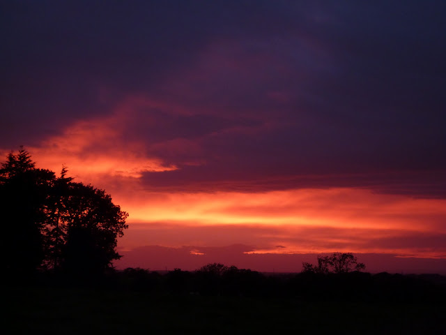
Sunset from High Stand Wood, Cumbria

We had an evening walk around High Stand Woods again and were rewarded by another glorious sunset.

Sunset from Englethwaite Hall, near Carlisle

Saturday, 27 August 2011

A Week in Cumbria - Day 1.

Another opportunity to get away from the grind. A week in the north west and the Lake District.

Lakes in High Stand Wood, Cumbria

Saturday was spent getting set up at the campsite, Englethwaite Hall, a few miles south east of Carlisle and mooching about the local area. The site is adjacent to High Stand Woods, a Forestry Commission forest, with lots of paths and tracks (for handy dog walking) and some fishing lakes (for views and interest). 

Sunset from Englethwaite Hall campsite


Sunday, 7 August 2011

Westerdale, North York Moors National Park

 
Baysdale, North York Moors

An excellent days walk in the north western area of the National Park, with a wild and exposed feel.


Baysdale, North York Moors
  
We were lucky enough to see a Hen Harrier over Stockdale Moor.

Captain Cook's Monument, from Ingleby Moor, North York Moors

Armouth Wath, North York Moors

From Stockdale Moor, North York Moors

Captain Cook's Monument and Roseberry Topping from Baysdale Moor

Footbridge on Great Hograh Beck, North York Moors

Great Hograh Moor, North York Moors

Route: Car park at Hob Hole (NZ651074), follow the road north, turn west on bridleway above Baysdale Beck, Baysdale Abbey, south to Armouth Wath, east then north east on bridleway over Stockdale Moor and Baysdale Moor, Great Hograh Moor, Little Hograh Moor, follow the road noth to start.

Statistics:  Distance:  15..9km  Ascent:  460m  Time:  4:30 hours

Beinn Bhrotain and Monadh Mor

Setting off from Glen Feshie - it was chilly - before the sun had a chance to peep over the hills...  Off we go! Jim - Setting off near Auch...